Winter storm for parts NY, NJ, CT: Slushy mix of rain, snow
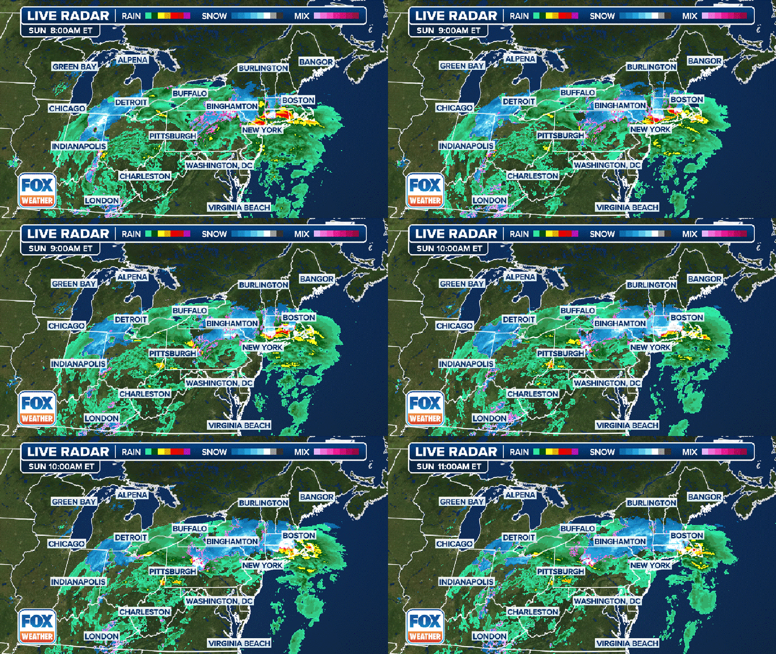
NEW YORK CITY - Millions of people in the Northeast and New England are dealing with a sloppy mess of heavy rain and some snow as a coastal storm slides across the region on Sunday.
Rain has been the name of the game as of Sunday morning, with heavy precipitation being reported from Pennsylvania and New York state to New Jersey and southern New England.
The National Weather Service said that much of the area has seen between 0.75 and 1.25 inches of rain.

A three-hour radar loop showing where rain (green), snow (blue) and mixed precipitation (pink) are ongoing in the Northeast and New England. (FOX Weather)
RELATED: Flight delays
Featured
Snow returning to NYC: Will we see accumulation from Sunday's storm?
NYC is bracing for another sloppy storm this weekend that will mix rain and snow, the weather forecast shows.
However, the FOX Forecast Center said the rain will eventually run into colder air pushing in from the north, which will help allow a changeover from rain to snow across interior portions of the region. But it will be a battle.
So, if you’re hoping for winter weather and you’re in New York City or along the Interstate 95 corridor, we’ve got some bad news – it’s not happening this time.

A look at the snow potential from Sunday through Monday. (FOX Weather)
The WPC noted that heavier snow will develop over eastern New York and northern New England, while some pockets of freezing rain will develop over eastern New York and into southern New England.
Sunday evening: As cold air from Canada arrives, we could see rain change over to snow in parts of the Tri-State, specifically north and west of New York City. The low, at the moment, is expected to linger just above the freezing mark in NYC. The National Weather Service says rain will be likely before 1 a.m. Temperatures will be in the mid 30s.
The National Weather Service said, "there could be a brief window where locations north of I-84 see moderate, wet snow."
Monday morning: Expect snow or a rain-snow mix before 9 a.m. and then a chance of rain between 9 a.m. and 3 p.m. The precipitation is forecast to gradually end in the morning, according to the National Weather Service.
The FOX Forecast Center isn’t expecting any accumulating snow along the I-95 corridor from New York City through southern New England due to warmer temperatures.
The temperatures will be colder farther north, and that’s where snow is likely to accumulate.
Calmer weather is in store for the Northeast for the rest of the week once this storm passes.
FOX Weather contributed to this report.


