

Will NYC see snow Thursday? Forecast shows major storm headed our way

NEW YORK CITY - ***MORE: Click HERE for the latest forecast.
Spring is in full bloom across NYC, but winter could return with a vengeance, the weather forecast shows – with the possibility of snow on Thursday.
JUMP TO: TUESDAY l WEDNESDAY l THURSDAY
"No, this is NOT an April Fool's Joke! Confidence is increasing that a significant winter storm will bring heavy snow and gusty winds to portions of the Great Lakes and Northeast later this week," the National Weather Service posted to X.
And even if we don't see flurries, heavy rain and gusty winds will create a major headache for commuters.
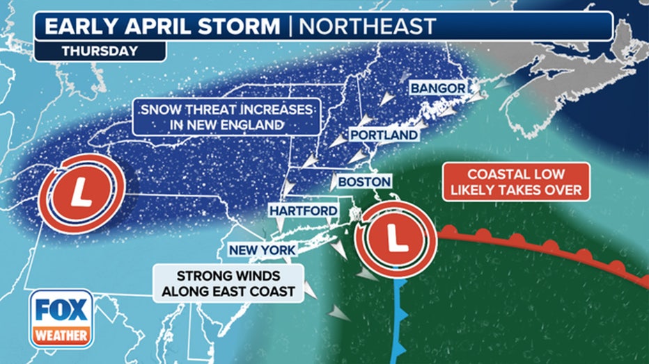
On Thursday, the coastal low takes over and pulls snow into the Northeast. The amount of snow depends on the storm's track. (FOX Weather)
Here's what we know so far about the storm, according to FOX Weather.
Tuesday
Rain moves into much of the Midwest to the Northeast. Severe storms with damaging winds, hail and possible tornadoes threaten the Ohio Valley into the Appalachians.
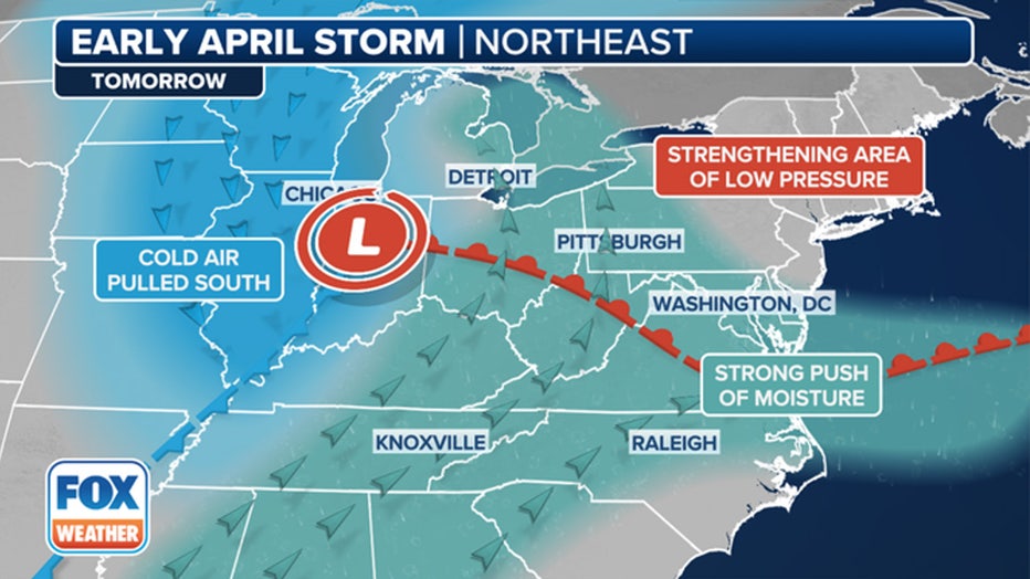
The initial low-pressure system brings rain across the Great Lakes and New England before the cold air wraps down behind the front changing the rain to snow. (FOX Weather)
Late in the day, snow starts to mix in across the Midwest and Great Lakes. Watch for a very dangerous period of sleet and freezing rain in Michigan for the late Tuesday commute before the snow takes over.
"The active weather on Tuesday will only be Round 1 as the stationary front begins to fall apart," the FOX Forecast Center said. "As we progress into Wednesday, the main low will start to linger around the Great Lakes. It is at this time that the forecast becomes more complicated."
The FOX Weather Center said the timing of the heavy snow is still up in the air, noting it could start as early as Tuesday night or hold off until Wednesday.
Wednesday
The coastal storm starts to take shape by Wednesday near the mid-Atlantic.
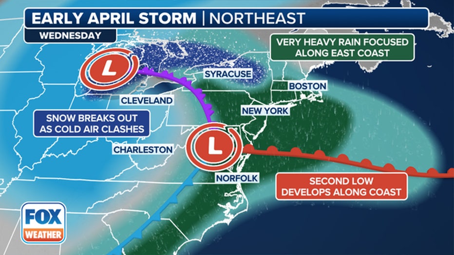
On Wednesday, the initial storm weakens and a coastal low develops as the rain and snow push east. (FOX Weather)
Computer weather models still differ on the placement and strength of the low. Forecast details will be refined as Wednesday approaches.
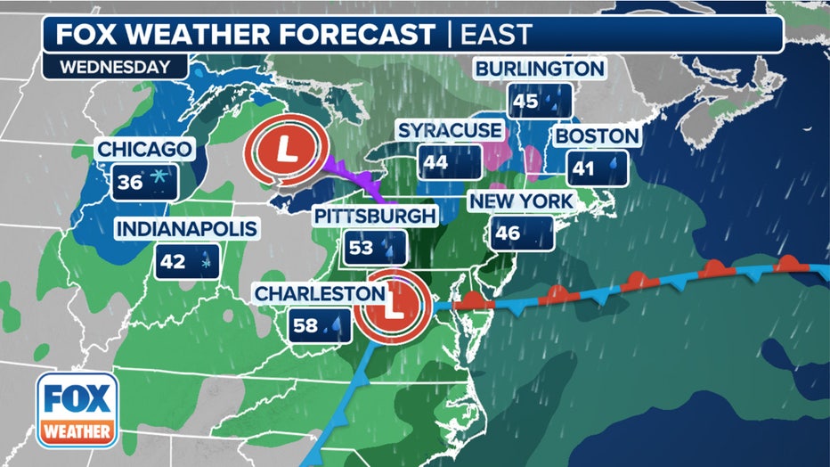
The forecast for Wednesday, April 3, 2024. (FOX Weather)
According to the FOX Forecast Center, there is potential for the low to develop into a major coastal storm. That could spell more heavy rain and snow closer to the Interstate 95 corridor, as well as gusty winds along the coast.
Thursday
Gusty winds will batter much of the Northeast.
Again, who gets snow versus rain along the I-95 corridor depends on the actual track and strength of the storm.
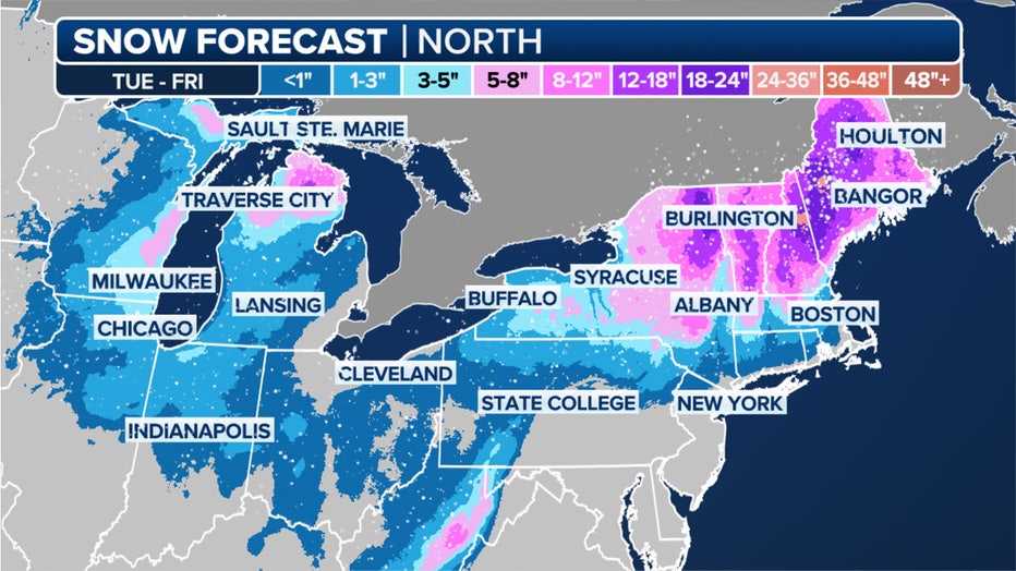
This graphic shows the forecast snow totals in the Great Lakes and Northeast this week. (FOX Weather)
With so many factors at play this week, it is too early to forecast the most probable outcome.
Snow continues to fall across New England on Thursday. If the low lingers off the New England coast, it could rapidly strengthen into a major storm like a nor'easter.
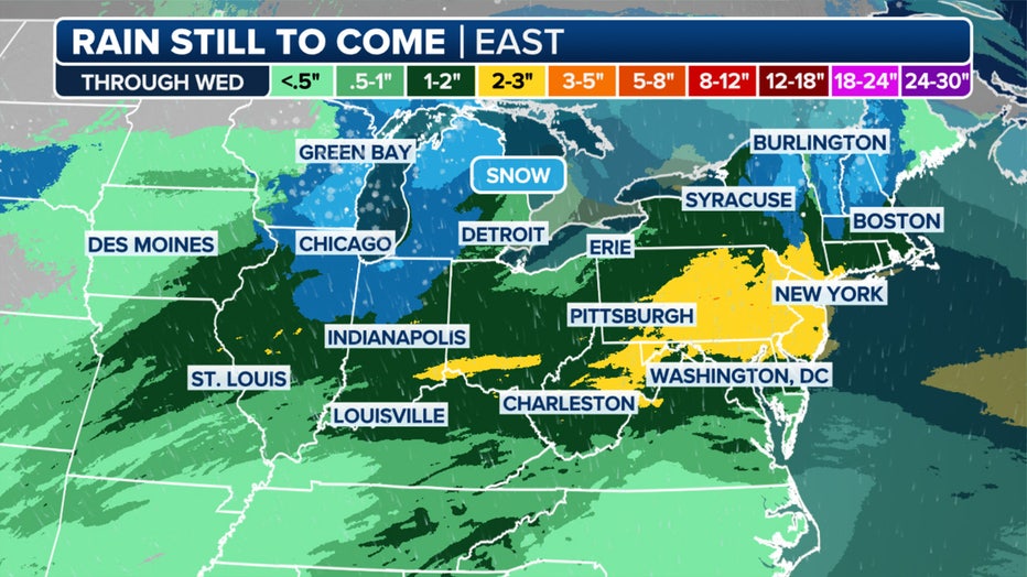
This graphic shows the forecast rain totals in the Great Lakes and Northeast this week. (FOX Weather)
FOX Weather helped contribute to this report.