

Winter storm hits NYC with snow, sleet and freezing rain: What's next?
NEW YORK CITY - A winter storm brought a mixed bag of freezing rain, snow, sleet and ice to the New York City area.
TODAY'S WEATHER: TIMELINE l IMPACTS l TRAFFIC l RADAR l WEEKEND STORM
The storm, which began as snow before transitioning to sleet and then freezing rain in some areas, created hazardous conditions for drivers and pedestrians alike on Thursday.
Winter weather advisory NYC
Winter weather advisories were expanded to include all the New York City metro, northeast New Jersey, Westchester and southern portions of Connecticut. Click here to track school closings and delays.
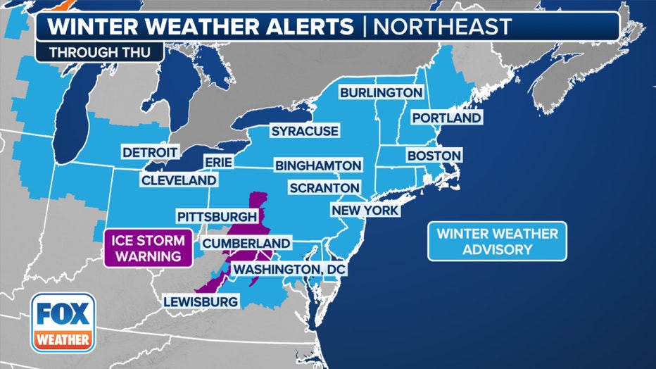
This graphic shows the winter weather alerts in effect in the Northeast and New England. (FOX Weather)
The storm's impact varied across the region. While New York City primarily saw sleet and some snow, areas north and west saw several inches of snow.
Latest weather update
Timeline:
The snow, which was heavy at times with large flakes, fell during the heart of the morning commute across the Tri-State area.
- Thursday: Snow and sleet, possibly mixed with freezing rain before 10 a.m., then rain. Patchy fog after noon. High near 39. The chance of precipitation is 100%.
However, warm air will then flood in, changing the snow to either freezing rain or plain rain.
How much snow are we getting today?
By the numbers:
Snow and sleet accumulations of up to 3 inches were possible for most of the Tri-State area.
As for ice accretion, a glaze is possible across portions of NYC metro, western Long Island and coastal Connecticut.
NYC live traffic map
Click HERE to open the embedded map in your browser.
JFK Airport status
- For more information from FlightAware, click HERE.
LaGuardia Airport status
- For more information from FlightAware, click HERE.
Newark Airport status
- For more information from FlightAware, click HERE.
NYC weather radar
Click HERE for more information.
Weather this week: Weekend storm?
What's next:
The system will quickly exit by Thursday, leaving mainly dry conditions in its wake on Thursday night and Friday. However, another winter storm could impact many of these same areas over the weekend.
Featured


Multiple snow, ice threats for NYC in February, including this weekend
Just as one storm packing snow and ice exits the NYC area, another is on the way to parts of NY, NJ and CT this weekend -- and next week.
That storm will reach the Northeast on Saturday night and produce another round of snow, sleet and freezing rain.
- Saturday: A 20% chance of snow after 1 p.m. Partly sunny, with a high near 36.
- Saturday night: Snow likely before 10 p.m., then snow and sleet between 10 p.m. and 4 a.m., then rain and sleet after 4 a.m. The temperature will fall to near 32 by 8 p.m., then rising to around 37 during the remainder of the night. The chance of precipitation is 100%.
- Sunday: A chance of rain and snow before 9 a.m. Cloudy, then gradually becoming mostly sunny, with a high near 40. The chance of precipitation is 50%.
What they're saying:
"As the storm continues east, an icy wintry mix is anticipated across the northern mid-Atlantic states Saturday night," the NOAA NWS Weather Prediction Center said in a post on Facebook.
Alternate side parking NYC
"#NYCASP rules are suspended today, February 6 to facilitate weather operations. Parking meters are in effect."
What we don't know:
"Uncertainty remains with the storm track and timing, which will play a critical role in where the heaviest snowfall occurs," the NOAA NWS Weather Prediction Center said in a post on Facebook.