Snow forecast: Winter storm could slam NYC on Monday
NEW YORK CITY - A potent winter storm early next week could bring "the potential for heavy snow" to the Northeast, which would include parts of the New York City area.
WINTER STORM SNOW FORECAST: MONDAY l WHAT'S NEXT? l RADAR
"We will be dry through the weekend and then on Monday, we have a chance of snow," FOX 5 NY's Liv Johnson said.

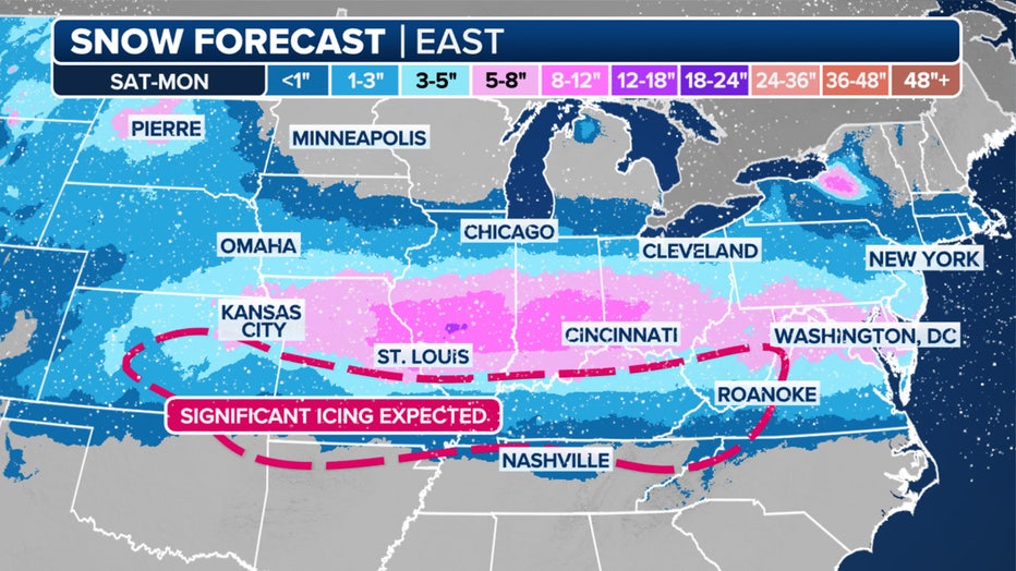
(This graphic shows the snow potential in the East through Monday. (FOX Weather))
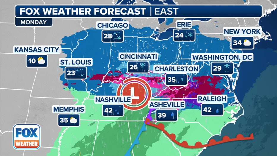
Though the storm is expected to weaken Monday upon crossing the Appalachians, wintry weather is still likely across the region, the FOX Forecast Center said.
"Monday, that chance of snow that we have to track as it gets closer," Johnson said.
Snow on Monday
The storm is forecast for Monday, when forecasters believe frigid artic air could pair with a system of precipitation to create snow.
According to NOAA's preliminary forecast, the snow threat begins in the overnight hours Monday and continues through the morning and afternoon, clearing out through the evening.
"A significant pattern change is expected across much of the country as an Arctic Outbreak is forecast to spread from the Northern Plains to the south and east, leading to exceptionally high probabilities of below-normal temperatures expected across much of the East," the National Weather Service Climate Prediction Center said in a post on "X."
The National Weather Service said frozen precipitation is possible across the middle parts of the country, and heavy snow could impact the Northeast.

A look at the weekend winter storm overview. (FOX Weather)
"Frozen precipitation is possible across the parts of the Southern Plains and Southeast with the potential for heavy snow extending northward to include much of Appalachians, Ohio Valley, Mid-Atlantic, Great Lakes, and Northeast," the agency said.
The National Weather Service's Weather Prediction Center (WPC) said while confidence in the storm is increasing, there remains uncertainty in its timing and track as it moves east.
"Uncertainty remains regarding the timing and location of the storm track, which will be important in determine where the most significant impacts will occur," the NOAA NWS Weather Prediction Center said in a post on Facebook.
What's next after the storm?
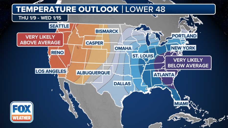
By next week, a significant arctic outbreak will send temperatures plummeting across the East Coast, and the air will be the coldest of the season so far.

This graphic shows the temperature outlook starting Jan. 9, 2025. (FOX Weather)
The FOX Forecast Center said the cold air will persist for the next few weeks, perhaps into the end of January, meaning the East Coast could be seeing its first colder-than-average January since 2022, and possibly even the coldest since 2014 or 2011.
Weather radar NYC
Click HERE for more information.


