

No blizzard, but NYC snow still possible on Thursday: Timing, what to expect

NEW YORK CITY - No, New York City is not getting a nor'easter on Thursday, but New Yorkers could still see some snow.
Accumulations won't be much, but the timing of the wet weather could make for a slick and slippery evening commute.
Here's the forecast for Thursday:
How much snow are we getting?
Timeline:
As of now, snow accumulations seem to be minor, if any.
- Thursday: A 30% chance of snow showers, mainly after 1 p.m. Clouds will increase throughout the day, with a high near 29.
- Thursday night: A 20% chance of snow showers before 1 a.m. Skies will be cloudy, then gradually becoming partly cloudy, with a low around 23.
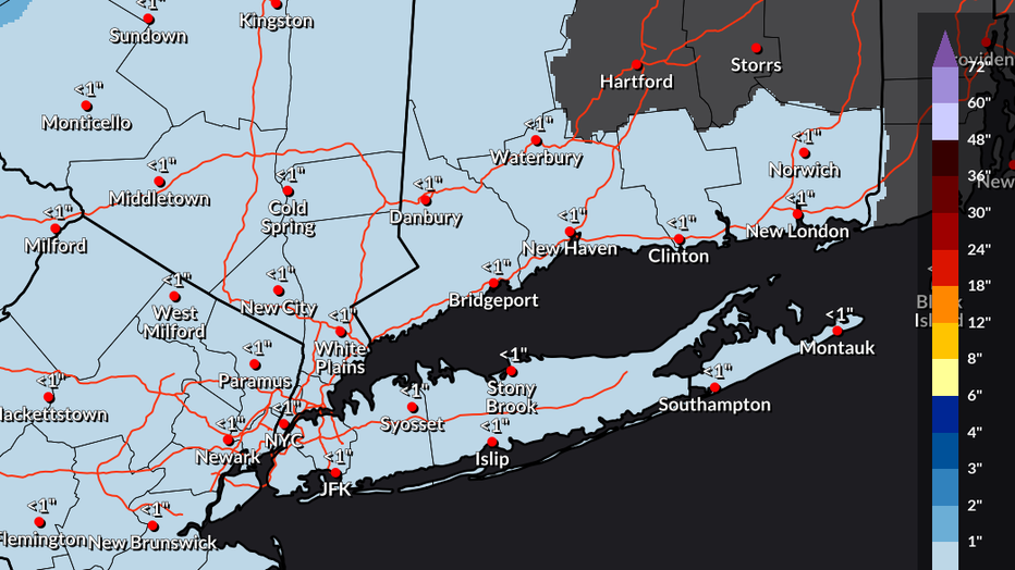
Photo credit: The National Weather Service.
According to the National Weather Service (NWS), there's a low chance for higher amounts in parts of New Jersey, depending on where the banding sets up.
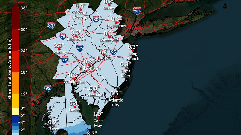
Photo credit: The National Weather Service.
"Elsewhere, a dusting of snow less than 0.5" is possible, mainly on Thursday with a chance of light snow showers or flurries," the NWS said in a post on X.
What they're saying:
"There are some snow showers that pass through very briefly, maybe for a couple of hours as we head through the afternoon Thursday into the evening," FOX 5 NY's Mike Woods said. "Maybe even some slick conditions on some of the roadways before this thing continues to head out into the Atlantic waters."
"Looks like for the most part, it's almost a blanket half an inch of snow," Woods said. "A coating, maybe a little bit better than that."
Big picture view:
Meanwhile, winter weather alerts are in effect for millions of people from Kentucky and Tennessee to the mid-Atlantic.
This includes Winter Storm Warnings that are in effect for cities such as Nashville in Tennessee; and Lynchburg, Richmond and Norfolk in Virginia.
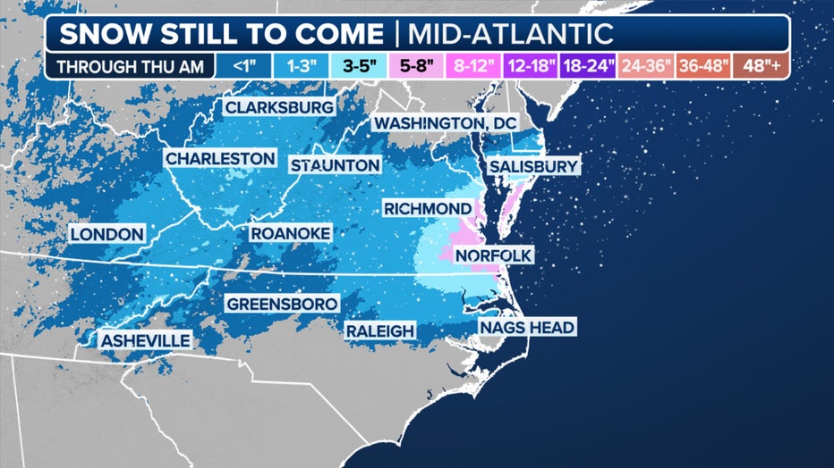
This graphic shows the forecast snow totals in the mid-Atlantic.(FOX Weather)
Due to the winter weather threat, the governor of North Carolina declared a state of emergency and prepared residents for treacherous travel conditions and power outages.
Starting Wednesday afternoon and into the evening, the heaviest snow will fall across the mid-Atlantic, especially in the Hampton Roads region of southeastern Virginia and far northeastern North Carolina.
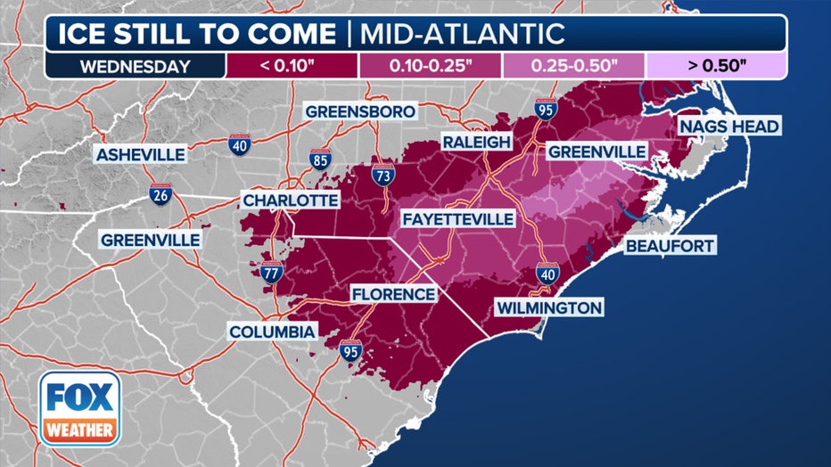
This graphic shows the forecast ice accretion in the mid-Atlantic.(FOX Weather)
Portions of southern Virginia and North Carolina, including Raleigh and Charlotte, are expected to experience icing later Wednesday through Wednesday night.
FOX Weather LIVE updates
NYC weather radar
Click HERE for more information.