Blizzard or bust: Will NYC see a major snowstorm this weekend?
NEW YORK CITY - Blizzard . . . or bust in NYC?
JUMP TO: AMERICAN MODEL l EUROPEAN MODEL l MIKE WOODS
Forecast models showing a major snowstorm for the New York City area this weekend have been making the rounds on social media. But in reality, that's only one model. At the same time, another model shows snow, but in a lighter form.
Here's what both models, and FOX 5 NY's Mike Woods, are saying about this weekend.
About the two models
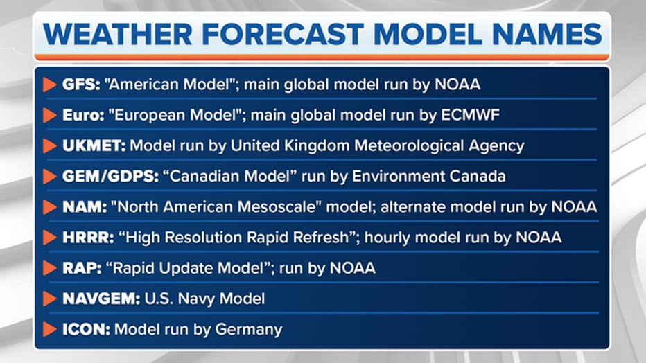
In the U.S., the two most popular models you'll see mentioned on social media are the Global Forecast System (GFS), also colloquially known as "The American Model", and the model run by the ECMWF, the European Centre for Medium-range Weather Forecasts, colloquially known as "The European" model, or "Euro" for short.

Photo credit: FOX Weather
NOAA runs the GFS with support from several other U.S. research and government entities. The ECMWF is based in England but is a private consortium supported by 34 European countries.
There are different models run by government weather agencies, but the Euro and GFS are the two you'll hear about most often.
Track real-time weather alerts and daily forecasts on the FOX LOCAL app. Click here to download on iPhone and here to download on Android.
What is the American model saying?
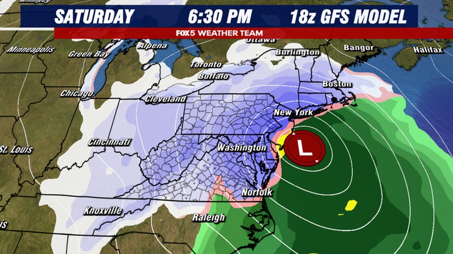
The American model is the one that has been making all the rounds on social media. For the better part of the past two days, it has been showing a major snowstorm for much of the East Coast.

Photo credit: FOX 5 DC
Storms like this tend to give certain areas not just multiple inches of snow, but the potential for feet of snowfall.
What is the European model saying?
The American model shows what is known as a phase. It's where a storm from the south links up with energy in the northern jetstream, creating a powerful nor'easter that turns northward up the coastline.

Photo credit: FOX 5 DC
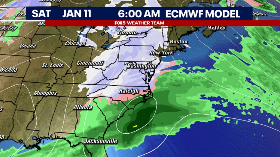
Recent runs of the European model have suggested that this connection will not actually happen. Without this phasing, the storm remains considerably weaker, and drifts across the southeast and then out to sea.
It does still show a period of potential light snowfall, but the amounts are considerably less than its American model counterpart.
What is FOX 5 NY's Mike Woods saying?
Woods seems to lean toward the side of the European model, meaning New York City will get some light snow, but not a blockbuster.
"The European model gives us very little, while the American model brings a moderate storm, but mainly to our south, Woods said.
Woods says "it just seems like that’s been our overall weather pattern so far this winter season at it seems most logical that things would stay that way."
It's cold!
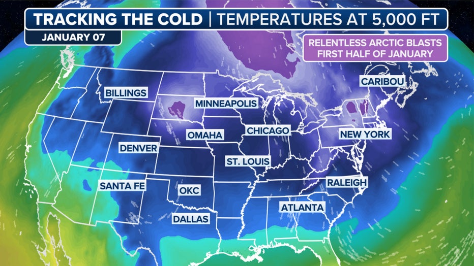
Meanwhile, the current cold air will have staying power, with forecast models indicating it will remain locked in the East in various magnitudes through the end of the month, the FOX Forecast Center said.

The FOX Forecast Center is tracking the cold this week. (FOX Weather)
This will all but ensure the East Coast has its first colder-than-average January since 2022, and perhaps the coldest since 2014 or 2011.

