

NYC area to miss out on 'major' midweek snowstorm: What happened?

What happened to this week's snowstorm for NYC?
Some computer forecast models showed the potential for a nor'easter this week in the NYC area. But fast-forward, and New York City is now likely to miss out on any meaningful snow. So, what happened? FOX 5 NY's Mike Woods has the story.
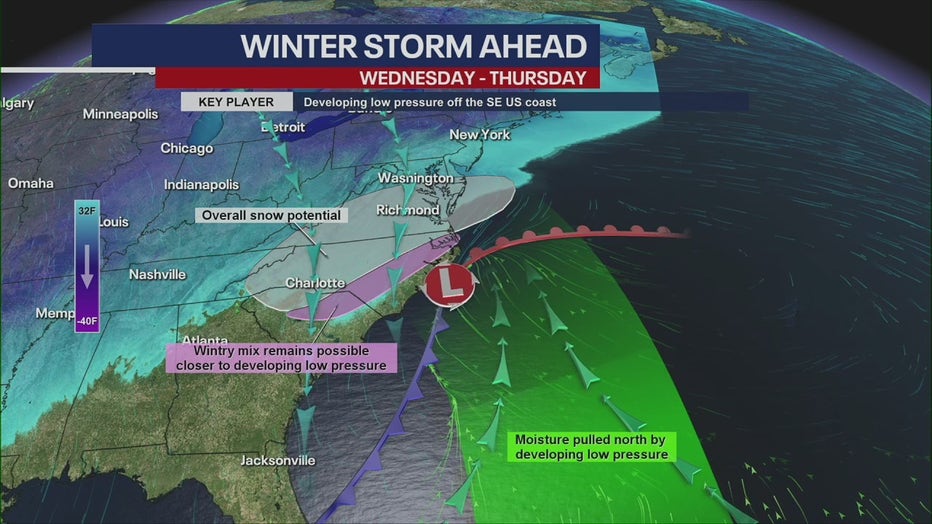
NEW YORK CITY - From 20+ inches of snow … to none … in New York City?
Forecast models that made the rounds on social media over the weekend showed a major snowstorm for the New York City area on Thursday. In fact, some computer forecast models even predicted a potential nor'easter, which would happen along the Interstate 95 corridor in the Northeast.
JUMP TO: ABOUT THE MODELS l WHAT HAPPENED l HOW MUCH WILL IT SNOW
But fast-forward to Tuesday, and the Big Apple is now likely to miss out on any meaningful snow, as the latest forecast shows the system staying farther south.
So, what happened?!
About the models
The backstory:
In the U.S., the two most popular models you'll see mentioned on social media are the Global Forecast System (GFS), also colloquially known as "The American Model", and the model run by the ECMWF, the European Centre for Medium-range Weather Forecasts, colloquially known as "The European" model, or "Euro" for short.
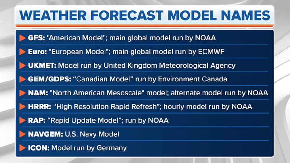
Photo credit: FOX Weather
NOAA runs the GFS with support from several other U.S. research and government entities. The ECMWF is based in England but is a private consortium supported by 34 European countries.
There are different models run by government weather agencies, but the Euro and GFS are the two you'll hear about most often.
The American model vs. the European model
In this case, the European model actually pulled the storm even further to the south, and has been trending in that direction time after time with all the updates, FOX 5 NY's Mike Woods said.
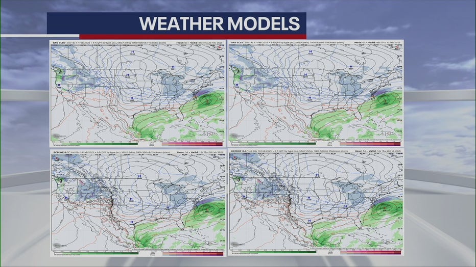
The American model (Top) and the European model (Bottom).
Blizzard bust?
What they're saying:
"Over the weekend, we had at points anywhere from 15 to 20 inches of snow, but now with the models taking shape with that storm off the southeast Atlantic Coast near the Carolinas," FOX 5 NY’s Mike Woods said. "It will bring the majority of the rain and wind and even the icy air conditions down over the Carolinas. We’re still not completely in the clear; we’ll still have to watch it closely."
Woods says it does look more and more like the storm is going to be more to the Southeast and therefore more of a bust, as opposed to a blizzard situation for the Tri-State area.
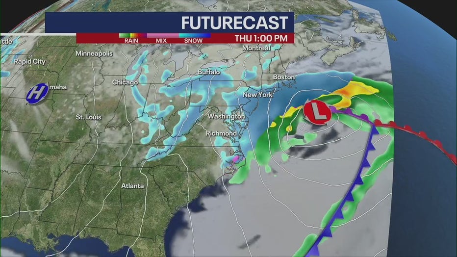
How much snow are we getting on Thursday?
According to the National Weather Service, there's a 30% chance of snow for New York City, mainly after 1 p.m.
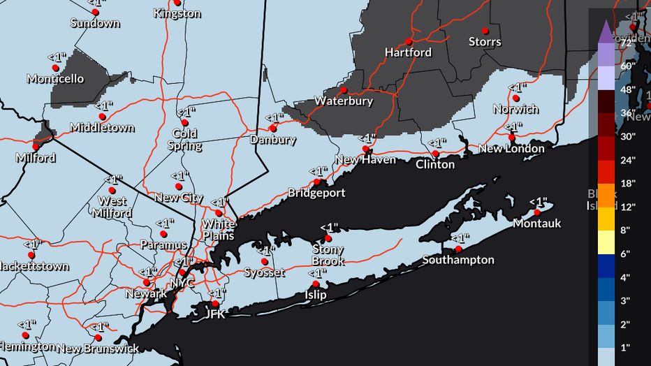
Photo credit: The National Weather Service.
As of now, snow accumulations seem to be minor, if any.

Photo credit: The National Weather Service.
FOX Weather LIVE updates
NYC weather radar
Click HERE for more information.