

NYC weather: Tri-state area at 'enhanced risk' for severe thunderstorms
NEW YORK CITY - The last day of June will be a stormy one, to say the least, as severe thunderstorms are heading our way, the National Weather Service reports.
"Our entire area is now outlined for an Enhanced Risk for severe thunderstorms," The NWS New York said on X.
The National Weather Service's Storm Prediction Center (SPC) has issued a Severe Thunderstorm Watch for parts of the Northeast and southern New England until 7 p.m. ET.
The SPC has highlighted more than 63 million people along the Interstate 95 corridor from North Carolina through Maine as having the highest severe weather threat.
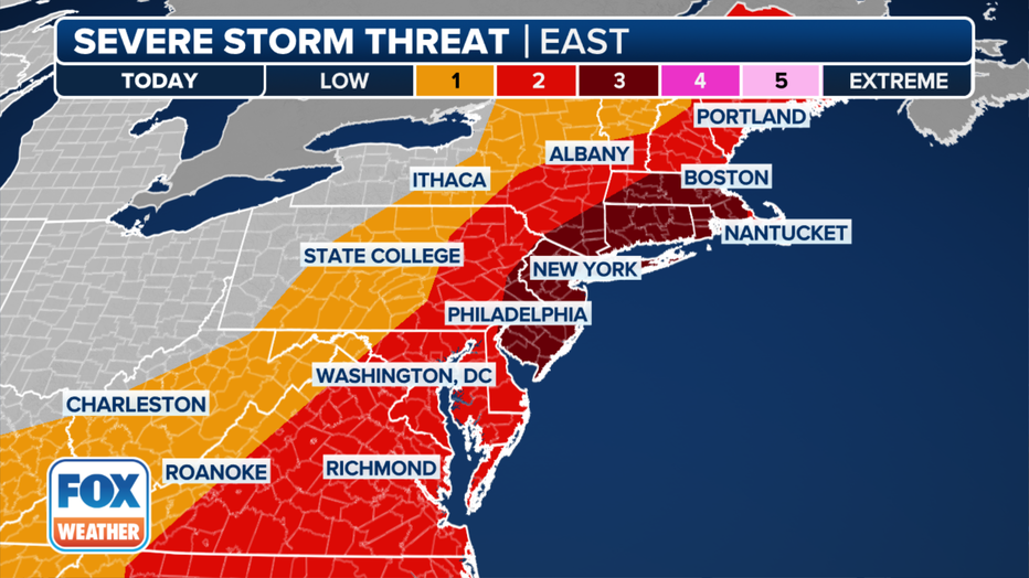
The severe storm threat on Sunday, June 30, 2024. (FOX Weather)
That includes a Level 3 out of 5 risk of severe weather that extends from New Jersey and eastern Pennsylvania into Massachusetts. Nearly 36 million are covered by this Level 3 risk in cities such as New York, Philadelphia, Boston and Providence in Rhode Island.
Damaging wind gusts are the primary concern with the storms, but large hail and a tornado or two are also possible. These threats will be highest in the Level 3 risk area in the Northeast and southern New England.
The cold front and associated severe weather threat will exit off the East Coast after sunset, leaving a much quieter Monday as the calendar flips to July.
Are there delays or cancelations at NYC-area airports?
Check the status of each airport below:
LaGuardia Airport status
- For more information from FlightAware, click HERE.
Newark Airport status
- For more information from FlightAware, click HERE.
JFK Airport status
- For more information from FlightAware, click HERE.
July 4th week forecast
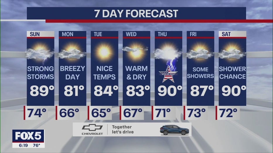
Today: Strong storms. 89.
Monday: Breezy day. 81.
Tuesday: Nice temps. 84.
Wednesday: Warm and dry. 83.
Thursday: Thunder. 90.
Friday: Some showers. 87.
Saturday: Shower chance. 90.
FOX Weather contributed to this report.