NYC weather today: Even heavier rain in forecast, Flood Watch issued

NYC weather forecast
FOX 5 NY's Nick Gregory shares what to expect as round two of rain approaches the NYC area.
NEW YORK - Sick of the rain? Too bad, NYC: The weather forecast shows much more is on the way.
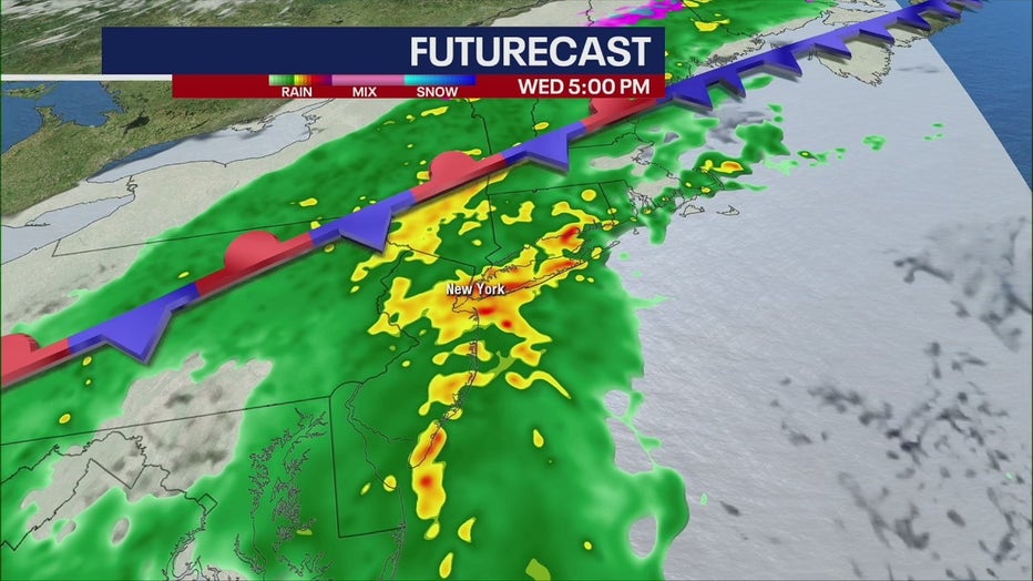
A stronger storm brings round two of rain Wednesday into Thursday, threatening New York, New Jersey and Connecticut with flooding along rivers and throughout urban areas. TRACK LIVE RADAR HERE.

A Flood Watch was issued for most of the area.
Here's what you need to know about the timeline of the storm, how much rain fell Tuesday and expected rainfall totals this week and weekend.
Weather timeline: 2nd storm on the way
Wednesday morning
Expect clouds and fog during the morning commute. Temperatures will reach a high of 54 degrees. Wind speeds will remain weak, around 5 miles per hour.

Wednesday afternoon
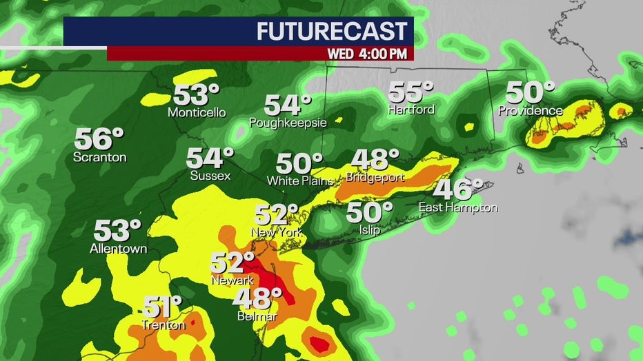
The powerful storm system from the south arrives around noon, and the intensity picks up by 3 p.m.

Wednesday night
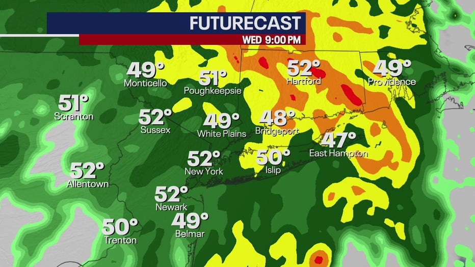
This is when rainfall rates peak at about 1 inch per hour, between 6 p.m. and 3 a.m. Thursday. Temperatures will dip to 44.

Thursday morning
The majority of the storm pushes north, with some scattered drizzle in NYC. The high temperatures will remain the same, around 52, but expect breezy conditions as the storm system moves away.
Thursday afternoon
Another round of rain returns around 1 p.m., but will fortunately be much weaker than Wednesday's system.
Friday
NYC gets a break, with sunny skies and a high of 55!
Weekend
Rain returns for the weekend, with the potential for another 1 to 2 inches. Additional flooding is possible.
Windy conditions are expected Sunday when that system exits the area.
Rainfall totals
New York City and northern New Jersey saw about ½ an inch of rain Tuesday, with lower totals on Long Island and Connecticut.

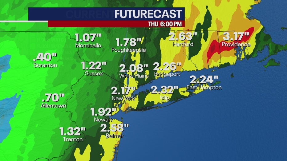
The city could see a little over 2 inches by Thursday evening, while parts of Long Island and Connecticut could see nearly 2 ½ inches. Areas further east aren't threatened by as much rainfall.
Significant flooding threats are possible throughout the entire area, according to the National Weather Service. Monitor river threats here.
"Soil moisture is running 60-80% above normal, with a majority of area rivers and streamflows running above to much above normal," according to the NWS. "This will allow for rainfall to more quickly become runoff and flooding. Each successive rain event will further elevate soil moisture and stream flows, increasing the urban and river flood threat."

