NYC snow forecast: 2-3 inches expected in NY, NJ; Winter Weather Advisory issued
NEW YORK - Click here for the latest on the NYC snow forecast.

Winter storm to bring 2-4 inches of snow to NYC
A snowy start to the weekend is on the way, as a winter storm is expected to bring 2-4 inches of snow to New York City.
The NYC weather forecast shows another snow storm rolling through the area Friday night into Saturday, bringing 2 to 3 inches of snow to northern NJ, Long Island and New York City. And if the storm shifts north, we could see even higher snow totals!
A Winter Weather Advisory takes effect from 10 p.m. until 1 p.m. Saturday, and NYC issued travel advisories for all five boroughs.
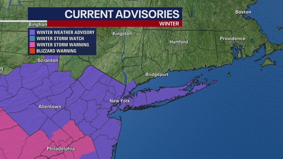
Here's what we know about timing, expected snow totals and the possible worst-case scenario.
Timeline: When will it snow in NYC?
Friday night
A light snow is set to begin late Friday night, mainly after 1 a.m. The area will see the bulk of snowfall overnight, with 2 to 3 inches of accumulation before sunrise.
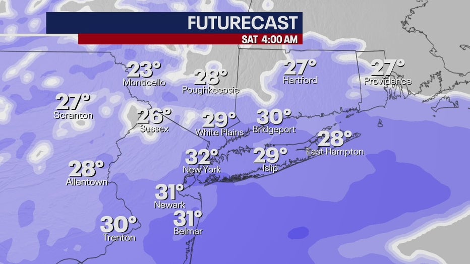
Snowfall will be fastest between 2 a.m. and 8 a.m. at rates of an inch per hour.
Temperatures will remain in the high 20s.
Saturday morning
The snow is expected to lighten around 10 a.m. and is forecast to leave the area around noon. The Winter Weather Advisory ends at 10 a.m.
While highs will reach the upper 30s, wind chill values will range between 25 and 30.
Drivers can expect slippery travel on snow-covered roads across the area.
Saturday afternoon
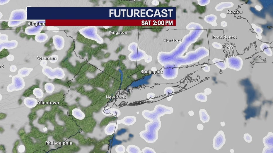
According to the National Weather Service, the NYC area still has a chance of scattered snow as late as 4 p.m. Snow could linger on eastern Long Island and Connecticut into the evening.
Saturday night
Skies will clear, with a low around 27. Wind chill values will make it feel as cold as 15 to 20 degrees.
Impacts: How much will it snow in NYC?
Two to 3 inches of snow is possible across parts of central and northern New Jersey, across Long Island, and in New York City. It's possible NYC and the surrounding areas could see between 4 to 5 inches.
The storm will mostly avoid the Lower Hudson Valley and much of Connecticut, with only 1 to 2 inches expected.
Southern New Jersey will likely see the most snow, with 4 to 6 inches forecast. A Winter Storm Warning was issued for several South Jersey and suburban Philadelphia counties.
Impacts: What is the worst case scenario?
According to the National Weather Service, the ultimate track of the low-pressure system will impact the total snowfall amount. A shift to the north will result in higher amounts and an expansion of the advisories north.
NYC, for example, could see up to 5 inches.
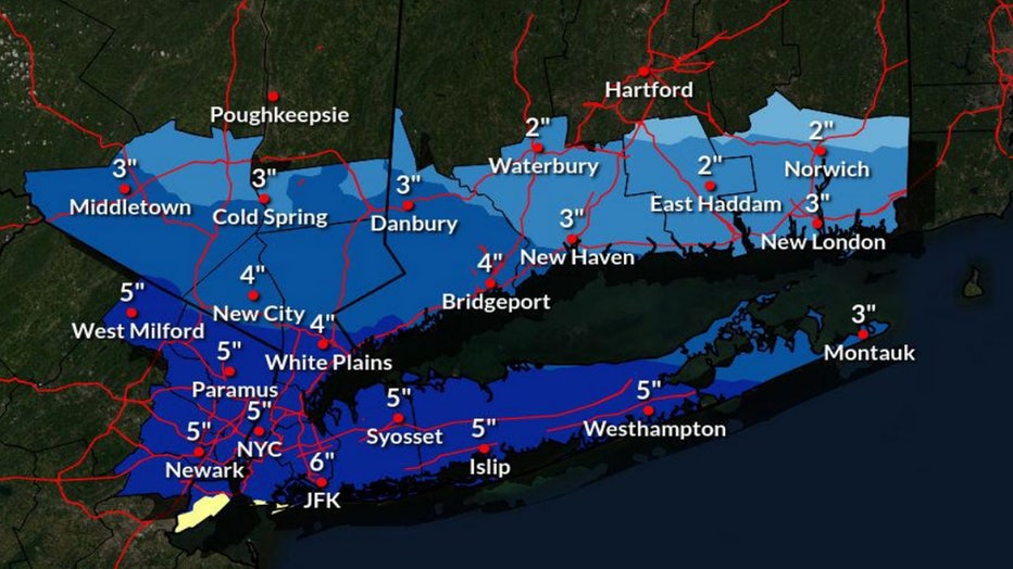
High end snow amounts
A shift to the south will reduce amounts. On the low end, New York City would only see 1 inch of snow.
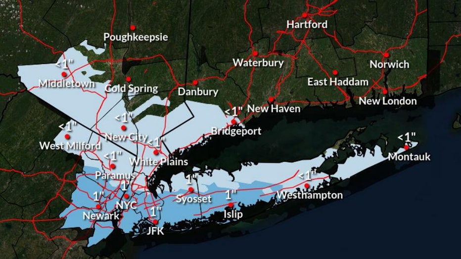
Low end snow amounts
Totals: How much snow fell Tuesday?
The NYC area saw several inches of snow following a major winter storm earlier in the week that impacted parts of New York, New Jersey and Connecticut.
Central Park recorded 3.2 inches, while parts of New Jersey and the Lower Hudson Valley saw up to a foot.

(Robert Moses/FOX 5 NY)
Click HERE to find out how much snow your area recorded, according to the National Weather Service.
Mid-winter weather outlook: ‘6 more weeks’ of winter
FOX 5 NY’s Nick Gregory said the NYC area has the potential for several more inches of snow, according to his mid-winter forecast.
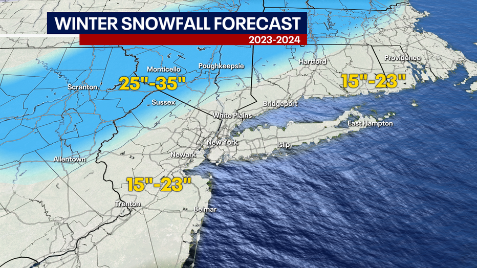
Map shows the snowfall total forecast for NYC, NY, NJ and CT for winter 2023-24. (FOX 5 NY)
Only one or two decent storms will help us reach the projected total, and Nick forecasts that February will provide the perfect conditions for winter storm development.
The U.S. is experiencing a strong El Niño, meaning the Tri-State is more likely to see warmer-than-average temperatures and wetter-than-average precipitation.
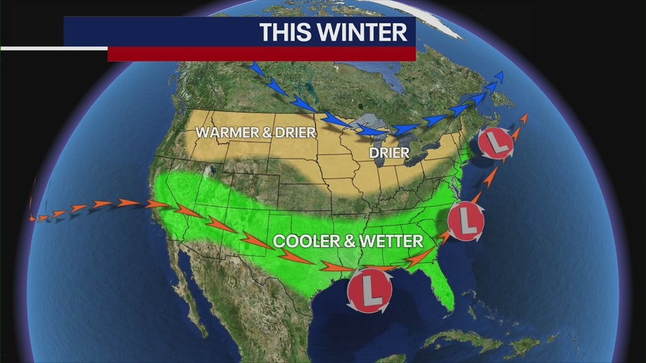
As we move forward, strong El Niño conditions will continue, meaning February will feature the same type of weather we've seen: above-average temperatures and borderline rain-snow events.
"I think winter will be prolonged here, and I do think that we'll probably have a good surge of cold weather coming in the middle part of February, [creating the potential for a snow storm or two," Nick said.
FOX Weather's Steven Yablonski helped contribute to this report.

