

NJ wildfire burns over 13K acres; expected to grow before it's contained

NJ wildfire now 50 percent contained
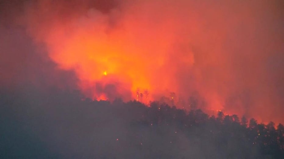
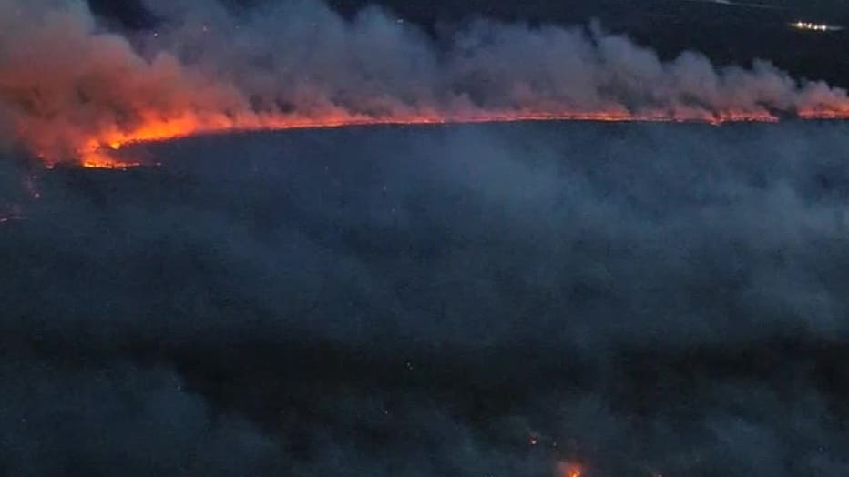
A fast-moving wildfire engulfing part of New Jersey’s Pine Barrens has not resulted in any injuries though it’s expected to continue to grow before forecast rain later this week. At a news conference Wednesday officials said the fire in southern New Jersey could continue to burn for days. It is currently burning about 20 square miles and is about 50% contained.
NEW JERSEY - A fast-moving wildfire burning in Ocean County, New Jersey has consumed over 13,000 acres and temporarily forced thousands of people to evacuate, though that order has since been lifted.
NJ WILDFIRE UPDATE: ROADS AFFECTED l GSP TRAFFIC l MAP l AIR QUALITY
The Jones Road Wildfire sparked on Tuesday in the Greenwood Forest Wildlife Management Area near Barnegat Township and quickly began to grow in size.
NJ Forest Fire Service
What we know:
As of the New Jersey Forest Fire Service's (NJFFS) last update on Wednesday, at 7:30 p.m., the wildfire had consumed 13,250 acres and was roughly 50% contained. Around 12 structures were threatened. Evacuation orders were lifted for the approximately 5,000 residents evacuated on April 22 in Lacey and Ocean Townships.
One commercial building has been destroyed, and multiple outbuilding and vehicles have been destroyed.
"This is still a very active fire," said Department of Environmental Protection Commissioner Shawn LaTourette. "As we continue to get this under full control the expectation is that the number of acres will grow and will grow in a place that is unpopulated."
Officials said the fire is believed to be the second-worst in the last two decades, smaller only than a 2007 blaze that burned 26 square miles.
Meanwhile, acting NJ Gov. Tahesha Way has declared a state of emergency in response to the wildfire.
"I am declaring a State of Emergency in Ocean County due to the Jones Road Wildfire in the Greenwood Forest Wildfire Management Area near Lacey, Ocean, and Barnegat Townships," Way said in a post on X.
Garden State Parkway traffic now
The Garden State Parkway and Route 9 have been reopened.
Click HERE to open the embedded map in your browser.
On Tuesday, dark smoke and ash were observed blowing across the parkway in surrounding Ocean County communities to the north and east, including Toms River, and closer to the beach in Seaside Heights.
Forest Fire Service fire engines, bulldozers and ground crews, as well as numerous local fire, rescue, county and state agencies were called in to help extinguish the wildfire.
What we don't know:
The cause of the wildfire remains unknown.
Forest fires are a common occurrence in the Pine Barrens, a 1.1 million-acre (445,000-hectare) state and federally protected reserve about the size of the Grand Canyon lying halfway between Philadelphia to the west and the Atlantic coast to the east. The region, with its quick-draining sandy soil, is amid peak forest fire season. The trees are still developing leaves, humidity remains low and winds can kick up, drying out the forest floor.
It's a vast wilderness in the country's most densely populated state. LaTourette, the DEP commissioner, said the fire is straddling an area on the edge of wilderness and residential areas.
"It’s the interface where the environment and development meet," he said.
The area had been under a severe drought until recently, when early spring rains helped dampen the region, but officials cautioned recent low humidity and a dry stretch have heightened the risk of fire.
JCPL outage map
As of Wednesday afternoon, Jersey Central Power and Light reported that over 25,000 customers who were without power have had it restored. The utility company had been asked to cut power Tuesday night as the fire was close to high voltage power lines.
NJ wildfire map
AirNow has an interactive Fire and Smoke Map for updates on blazes in your area.

NJ wildfire update: Smoke forecast for NYC area
FOX 5 NY's Audrey Puente has the latest details on the wildfire in Ocean County, NJ, as well as the smoke forecast for the NYC area.
The National Interagency Fire Center has also partnered with NASA to provide real-time interactive fire maps.
Air quality near me
This map from AirNow.gov shows the current air quality. Click HERE if you're having trouble viewing the embedded map.