

Hurricane Lee churns through Atlantic as it heads north
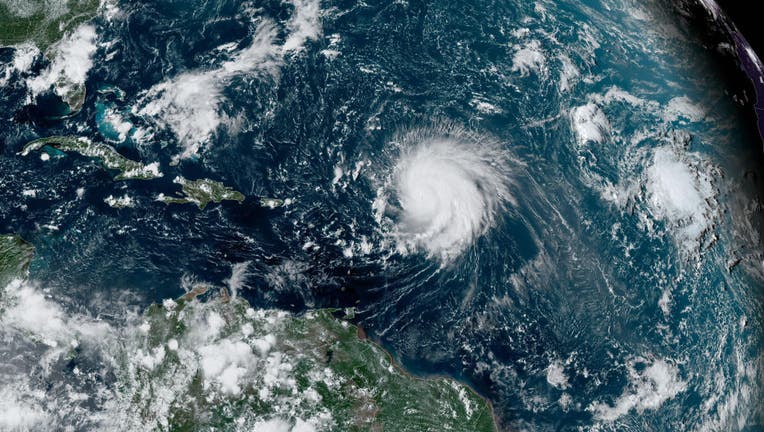
In this NOAA image taken by the GOES satellite, Hurricane Lee crosses the Atlantic Ocean as it moves west on September 8, 2023. (Photo by NOAA via Getty Images)
SAN JUAN, Puerto Rico - Hurricane Lee whirled north of Puerto Rico on Tuesday as a Category 3 storm, with forecasters noting it would remain in open waters through this week while on a path to Atlantic Canada.
The storm was located about 555 miles (895 kilometers) south of Bermuda. It had winds of up to 115 mph (185 kph) and was moving west-northwest at 6 mph (9 kph).
A tropical storm watch was issued for Bermuda, with Lee forecast to pass just west of the island late Thursday, the National Hurricane Center said.
By Sunday, Lee was forecast to weaken into a tropical storm and likely make landfall in Nova Scotia, Canada, according to AccuWeather.
"A significant storm surge will occur along with the strongest winds and risk of property damage," AccuWeather said in a statement.
In New York City, the Office of Emergency Management announced that it is continuing its monitoring and preparedness activities in advance of potential impacts from the storm, although it poses no immediate threat to the city.
"At this time, no significant winds, rain or flooding is expected in NYC. However, indirect impacts, such as high surf and dangerous rip currents, are likely to develop along Atlantic-facing beaches tomorrow," NYCEM said in a statement.
NYC Emergency Management issued the following guidance to help New Yorkers keep themselves and their families safe, regardless of the storm's ultimate course:
- KNOW YOUR ZONE Areas of NYC prone to storm surge flooding are divided into six evacuation zones. Be aware of your evacuation zone; visit NYC.gov/KnowYourZone to check if you're in one of these areas. During a coastal storm, evacuation orders may be issued for residents in hurricane evacuation zones.
- Areas of NYC prone to storm surge flooding are divided into six evacuation zones.
- Be aware of your evacuation zone; visit NYC.gov/KnowYourZone to check if you're in one of these areas.
- During a coastal storm, evacuation orders may be issued for residents in hurricane evacuation zones.
- MAKE A PLAN Develop a comprehensive emergency plan to ensure the safety of you and your family. Visit NYC.gov/ReadyNY for resources and guidance on creating your plan.
- Develop a comprehensive emergency plan to ensure the safety of you and your family.
- Visit NYC.gov/ReadyNY for resources and guidance on creating your plan.
- STAY INFORMED Sign up for Notify NYC, the official, free emergency communications program of the City of New York. Receive emergency notifications via the Notify NYC mobile app, NYC.gov/notifynyc, 311, or @NotifyNYC on Twitter. Messages are available in 13 languages, including American Sign Language.
- Sign up for Notify NYC, the official, free emergency communications program of the City of New York.
- Receive emergency notifications via the Notify NYC mobile app, NYC.gov/notifynyc, 311, or @NotifyNYC on Twitter.
- Messages are available in 13 languages, including American Sign Language.
For more safety tips, visit NYC.gov/SevereWeather
Lee is expected to weaken in upcoming days as it enters cooler waters.
"Despite the weakening that is forecast, keep in mind that the expanding wind field of Lee will produce impacts well away from the storm center," the hurricane center said.
Lee was generating dangerous surf and rip currents for the Lesser Antilles, the British and U.S. Virgin Islands, Puerto Rico, Hispaniola, the Turks and Caicos Islands, the Bahamas, Bermuda and parts of the southeast U.S. coast. Those conditions were expected to soon spread to the U.S. East Coast.
"It remains too soon to know what level of additional impacts Lee might have along the northeastern U.S. coast and Atlantic Canada late this week and this weekend," the National Hurricane Center said.
Lee is the 12th named storm of the Atlantic hurricane season, which runs from June 1 to Nov. 30 and peaked on Sunday.
Meanwhile, Margot became the fifth named hurricane of the season on Monday. It was located some 890 miles (1,430 kilometers) southwest of the Azores. It had maximum sustained winds of 85 mph (140 kph) and was moving north at 12 mph (19 kph). Margot is forecast to remain over open waters.
The National Oceanic and Atmospheric Administration has forecast 14 to 21 named storms this season. Six to 11 of those are expected to strengthen into hurricane, and of those, two to five could develop into Category 3 storms or higher.
With the Associated Press.