

Flood threat lingers in New York, Long Island after storms hit DC, Philly and New Jersey
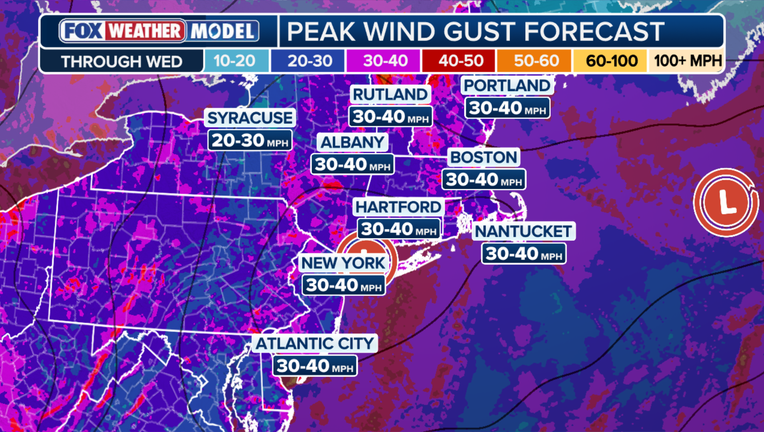
Rounds of heavy rain are creating a flash flood risk across the Northeast, with parts of New York, Connecticut and New England facing the greatest threat through Wednesday.
NEW YORK - Heavy rain continues to affect parts of the Northeast Wednesday after storms moved through the corridor from Washington and Philadelphia to New Jersey and New York.
The greatest remaining flood threat within the region is focused on parts of New York City, the Lower Hudson Valley and Long Island as the storm system shifts toward New England.
Where is the flood risk?
The Weather Prediction Center placed the Bronx, Westchester County and parts of Long Island under a Level 2 out of 4 risk for flash flooding Wednesday.
The risk also includes New York’s Capital Region and portions of coastal Connecticut.
Flash Flood Warnings were issued for parts of the Lower Hudson Valley, including Westchester, Putnam and Dutchess counties, as heavy rain moved across the region.
New York and Long Island
A secondary area of low pressure formed off the coast of Long Island, sending heavy rain across the Island, Upstate New York and southern New England.
Eastern Long Island could also experience wind gusts between 30 and 40 mph Wednesday afternoon.
The heaviest rain is expected to continue shifting east through the day.
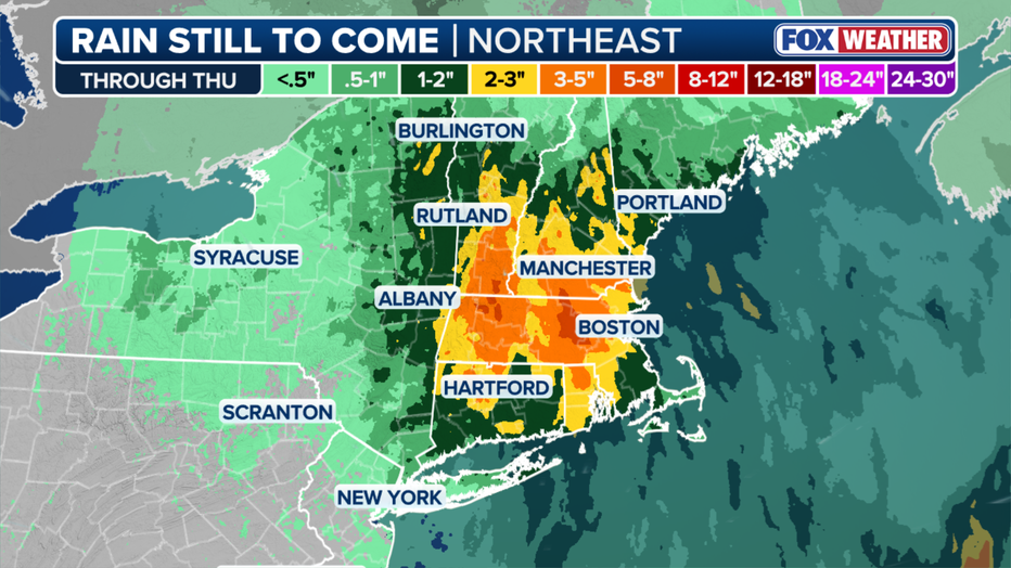
Northeast rain outlook(FOX Weather)
New Jersey
Heavy rain and hail struck parts of northern New Jersey Tuesday as the storm system moved through the region.
Video from North Haledon showed the community being hit by heavy rain and hail.
New Jersey was also included in a Tornado Watch issued Tuesday evening before the main severe weather threat moved north and east.
Philadelphia
The storms disrupted air travel in Philadelphia on Tuesday as heavy rain spread across the Northeast.
Hundreds of flights were canceled at airports serving Philadelphia, New York City and Boston, according to FOX Weather.
Pennsylvania and Delaware were also included in Tuesday evening’s Tornado Watch.
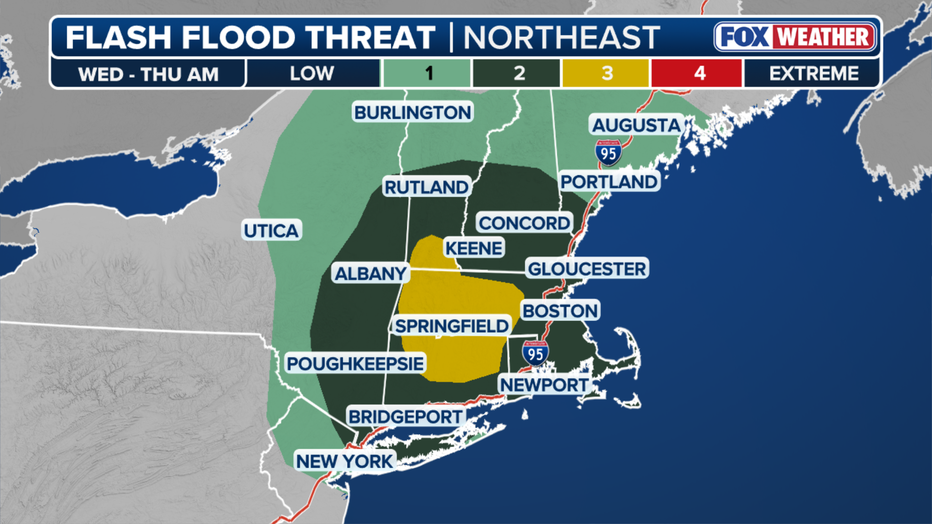
Flash flood threat(FOX Weather)
D.C., Maryland and Virginia
Washington, D.C., Maryland and Virginia were included in the Tornado Watch as storms moved through the Mid-Atlantic Tuesday evening.
The threat has since shifted away from the D.C. region and toward New York and New England.
How much rain could fall?
Combined rainfall totals from Tuesday and Wednesday could exceed 3 to 5 inches in some areas.
The strongest downpours could produce rain at rates of more than 1 to 2 inches per hour, increasing the risk of flooded roads and rapid rises along smaller streams.
What's next:
Rain could linger across parts of the Northeast through Thursday as the storm system gradually weakens.
The rain is expected to become less widespread during the day Thursday, although occasional downpours will remain possible.
How to prepare
Drivers should avoid flooded roads and never attempt to travel through standing water.
Residents in areas under flood alerts should keep weather notifications turned on and be prepared to move to higher ground if flooding develops quickly.
The Source: This article was written using information from FOX Weather and the NOAA Weather Prediction Center.