

Google Maps will soon estimate your tolls
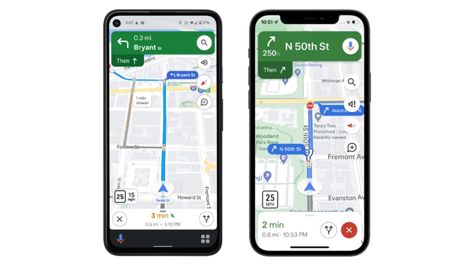
Google Maps screenshots (Courtesy of Google)
Soon motorists will be able to see an estimate of how much they'll pay in tolls heading to their destinations thanks to Google Maps. The toll estimator is part of an update coming to the navigation app.
"We look at factors like the cost of using a toll pass or other payment methods, what the day of the week it is, along with how much the toll is expected to cost at the specific time you'll be crossing it," Google Maps product manager Rubén Lozano-Aguilera wrote in a blog post. "Not a fan of toll roads? No problem. When a toll-free route is available, we'll still show you that route as an option."
Get breaking news alerts in the free FOX5NY News app | Sign up for FOX 5 email newsletters
The update will also show what Google calls "rich details" so that drivers can navigate unfamiliar roads "with confidence."
"You'll soon see traffic lights and stop signs along your route, along with enhanced details like building outlines and areas of interest," Lozano-Aguilera wrote. "And, in select cities, you'll see even more detailed information, like the shape and width of a road, including medians and islands—you can better understand where you are, and help decrease the odds of making last-minute lane changes or missing a turn."
The update will also allow Apple Watch users to begin navigating directly from the Google Maps shortcut on their watch.
"Starting in a few weeks, you'll no longer need to begin navigation from your iPhone," the blog post stated. "Simply tap on the Google Maps shortcut in your Apple Watch app, and the navigation will start automatically on your Apple Watch."
Google Maps screenshots (Courtesy of Google)