Debby tracker: Path through NYC, storm timeline, tornado threat
NYC Weather Forecast
FOX 5 NY's Mike Woods has the latest on Post Tropical Depression Debby and today's cooler temperatures.
NEW YORK - Check here for the latest updates on Debby.
Debby, formerly a hurricane, is crawling toward New York City, promising to bring rain, thunderstorms and even a tornado threat to the already-soaked Tri-State area.
According to the National Weather Service, Debby is now a post-tropical depression and will slam NYC tomorrow.
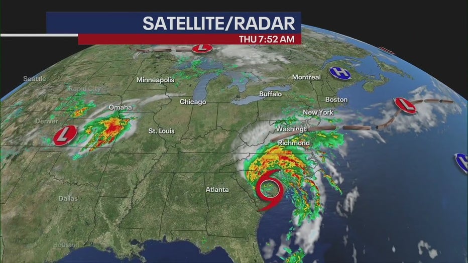
Here's what you need to know about Debby's path, timeline, changes to the forecast and the looming threat of tornadoes.
Debby's path
As of Thursday morning, Debby was moving slowly over the Carolinas toward Virginia.
"That thing is moving slow. It's moving to the north and northeast around five to six miles per hour," said FOX 5 NY meteorologist Mike Woods. "That's why it's taking so much time to get here."
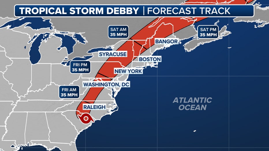
The storm is forecast to approach the Tri-State from the west, first plowing through Pennsylvania, then hitting New Jersey and New York before moving north through Connecticut and leaving our area.
Timeline
Thursday morning
Temperatures lingered in a cool, unseasonable mid-60s. According to Woods, an area of low pressure is drawing in a coastal east wind from the Atlantic Ocean, creating the cool-down.
Thursday
Expect clouds and drizzle throughout the day and into the night with a high of 74.
Friday morning
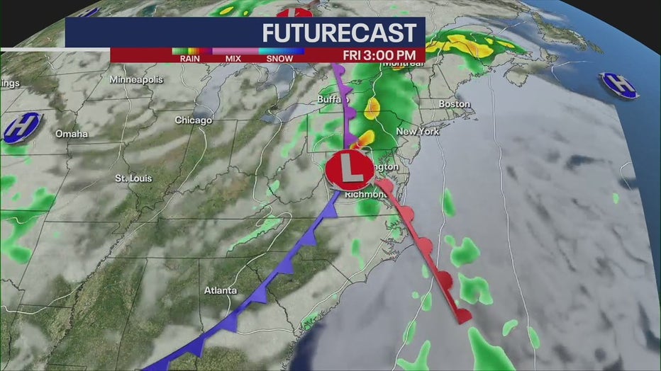
During the morning commute, expect cloudy skies before the storm approaches NYC from the west.
Friday afternoon
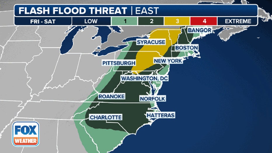
The storm connects with the cold front and hits New Jersey first, followed by New York, before moving north.
At this point, isolated severe thunderstorms could bring strong wind gusts and possible tornadoes to the area.
Friday evening
The storm will reach its peak between 7 p.m. and 9 p.m.
Saturday morning
The storm will clear by Saturday morning, but river flooding threats could linger.
What's new?
According to the National Weather Service, "the system continues to trend faster with lower rainfall amounts for our area."
Tornado threat
As Debby mixes with an area of low pressure, severe thunderstorms bring a tornado risk, according to the National Weather Service in New Jersey.
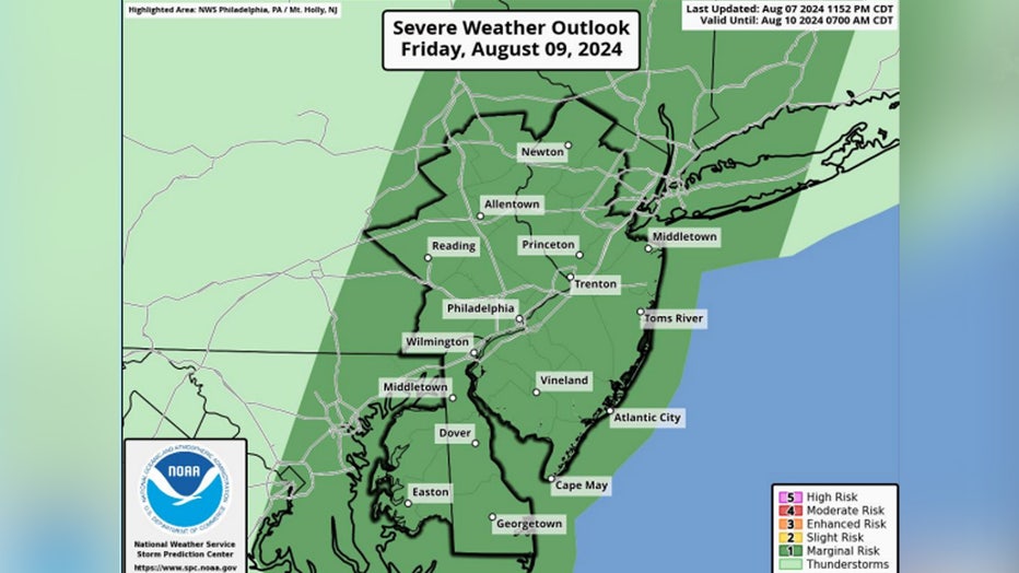
"A more inland track of the remnants of Debby places our region in the more favorable zone for the tornado risk," the agency reported.
Rain totals
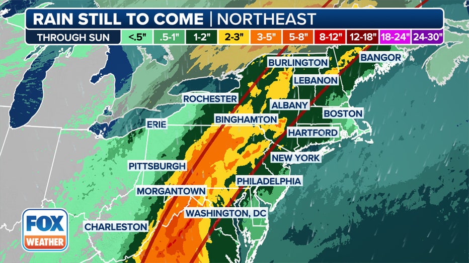
About 1 to 3 inches of rain are expected in New York City. The NWS still warns of scattered flooding throughout urban areas.
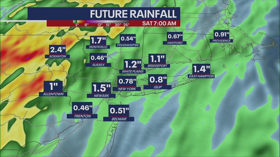
New Jersey can expect the most rainfall, and rivers may crest after a week of consistent rain.
Long Island and southern Connecticut will see less, around 1 inch.

